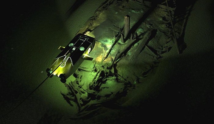
"The wrecks are a complete bonus, but a fascinating discovery, found during the course of our extensive geophysical surveys," said principal investigator Jon Adams, from the University of Southampton in the UK.
"They are astonishingly preserved due to the anoxic conditions (absence of oxygen) of the Black Sea below 150 metres."
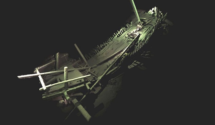
The Black Sea Maritime Archaeology Project team was able to record their findings in incredible detail thanks to their two new ROVs. These were being used in tandem to record geophysical data from the bottom of the sea, and were connected to a research vessel called the Stril Explorer.
You can see one of the ROVs below:
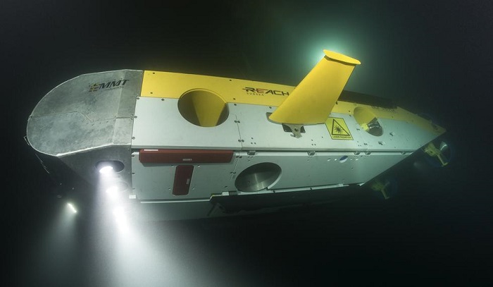
One of the ROVs is equipped with a high-resolution camera that allows the team to reconstruct images in 3D photogrammetry - an imaging technique that renders a 3D image from a scan of the sea floor.
The other ROV is designed for speed and utility, offering a way to cover more ground faster than other ROVs, while carrying lights, a laser scanner, and other geophysical equipment.
So far, these two ROVs have covered a total distance of 1,250 kilometres (777 miles), at a depth of 1,800 metres (5,905 feet).
"Using the latest 3D recording technique for underwater structures, we’ve been able to capture some astonishing images without disturbing the seabed," Adams said.
"We are now among the very best exponents of this practice methodology and certainly no-one has achieved models of this completeness on shipwrecks at these depths."


-1780923278.jpg&h=190&w=280&zc=1&q=100)