Seafront residents in Jaywick, near Clacton-on-Sea, were moved to temporary accommodation as the Environment Agency warned coastal communities in Lincolnshire, Norfolk, Suffolk and Essex to be prepared for gale force winds, large waves and possible flooding.
The Ministry of Defence said around 100 soldiers from the Catterick army base have been deployed to Skegness on the Lincolnshire coast, where around 3,000 residents have been urged to leave their homes or move upstairs.
As heavy snow settled across Scotland, Northern Ireland and parts of England on Thursday, travel was disrupted and some schools closed.
With a forecast of further snow and wind, 80 flights were cancelled at Heathrow and four at Gatwick, and passengers were advised to check flight status with airlines before travelling to airports.
Severe weather warnings were issued by the Met Office for many parts of the country as a “real taste of winter” hit, caused by a polar airmass that originated over northern Canada.
The east coast was set to bear the brunt. The Environment Agency warned gale force winds, combined with high tides, could result in large waves carrying dangerous debris through Friday and into Saturday. The army was on standby to assist, and resources and equipment had been moved to the coast, the agency said.
Parts of Suffolk were identified as being at high risk of flooding on Friday night, including Lowestoft seafront and docks, the north bank of Lake Lothing, Oulton Broad near Mutford Lock, Snape, Iken and surrounding marshland, and Southwold and surrounding marshes.
Around midday on Friday the Environment Agency is anticipating severe flooding in the following areas: Felixstowe Ferry and Bawdsey Quay, Felixstowe Ferry Hamlet and the Deben Marshes, Isolated riverside properties on the Deben Estuary, and Tidal Orwell at Ipswich Quay.
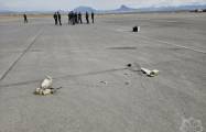
Mark Sitton-Kent, national duty manager at the Environment Agency, warned photographers and thrill-seekers: “We understand that powerful tides can be dramatic, but please do not put yourself at unnecessary risk by going to the coast for a thrill or to take pictures.”
Police officers were going house to house in Jaywick, informing residents of the evacuation to a nearby rest centre, due to begin at 7am on Friday. Ch Insp Russ Cole of Essex Police said: “Acting on all the professional guidance and experience of our colleagues at the Environment Agency and the Met Office, a partnership decision has been taken to evacuate the homes in Jaywick to ensure the safety of all residents.” The decision had “not been taken lightly”.
The government’s flood warning information service pinpointed several areas in Lincolnshire as being at risk from a large tidal surge moving down the east coast on Friday. The areas included sea defences in Cleethorpes.
High tidal levels along the Humber estuary, combined with strong winds, could result in large waves overtopping the sea defences, officials said, adding: “The public are advised to stay away from the coast for their safety.” A flood warning was issued for waterside properties in Boston between Town Bridge and Haven Bridge.
Environment Agency teams moved 5,200 metres of temporary barriers and 25 pumps to depots and towns including Newcastle upon Tyne, Blythe, Great Yarmouth, Chelmsford, Rye, and Trusthorpe and South Ferriby in Lincolnshire. The Hull tidal barrier was being operated on Thursday evening, while all east coast flood gates have been closed.
The heaviest and more frequent snow showers are expected across northern and western Scotland, Northern Ireland and around Irish Sea coasts.
There were yellow “be aware” warnings of wind and snow for Scotland with gusts of up to 60 mph in places, and 4in (10cm) to 8in (20cm) of snow on higher ground. The warnings extended to northern parts of England and Wales. In Northern Ireland, thick know blanketed Coleraine and Ballymena.
Paul Gundersen, chief meteorologist at the Met Office, said: “Most northern areas are very likely to see snow showers at times over the next few days but the situation over the southern half of England is more complicated.
“Forecasting snow is always challenging and there’s often a fine line between whether it will rain or snow in a particular location depending on slight changes in air temperature.”
The outlook for the UK over the weekend was for generally dry weather on Saturday with sunny spells across most of England and Scotland and a few showers, locally wintry, in Northern Ireland and western and easternmost part of Britain. Sunday will be wetter and milder, with longer spells of rain in the south and some mist and fog developing later.
More about:


-1780923278.jpg&h=190&w=280&zc=1&q=100)